
 1 / 5
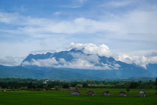
Doi Luang Chiang Dao is a huge limestone massif in Chiang Dao district, about 75 km north of Chiang Mai. Its summit, at 2,175 m, is among the highest points in Thailand and the highest limestone peak in the country. The mountain lies inside the Chiang Dao Wildlife Sanctuary, a UNESCO biosphere reserve since 2021, and it can be climbed only in the cool season, roughly November to March, with a permit, a licensed local guide and porters. It is about 90 minutes by car from the Old City and 105 minutes from Mae Hia, so most people plan two days with a night on the mountain.
Why go
Doi Inthanon is higher, but you can drive to its top. Doi Luang Chiang Dao has to be earned on foot. It rises as a sheer grey wall above the rice fields of Chiang Dao.
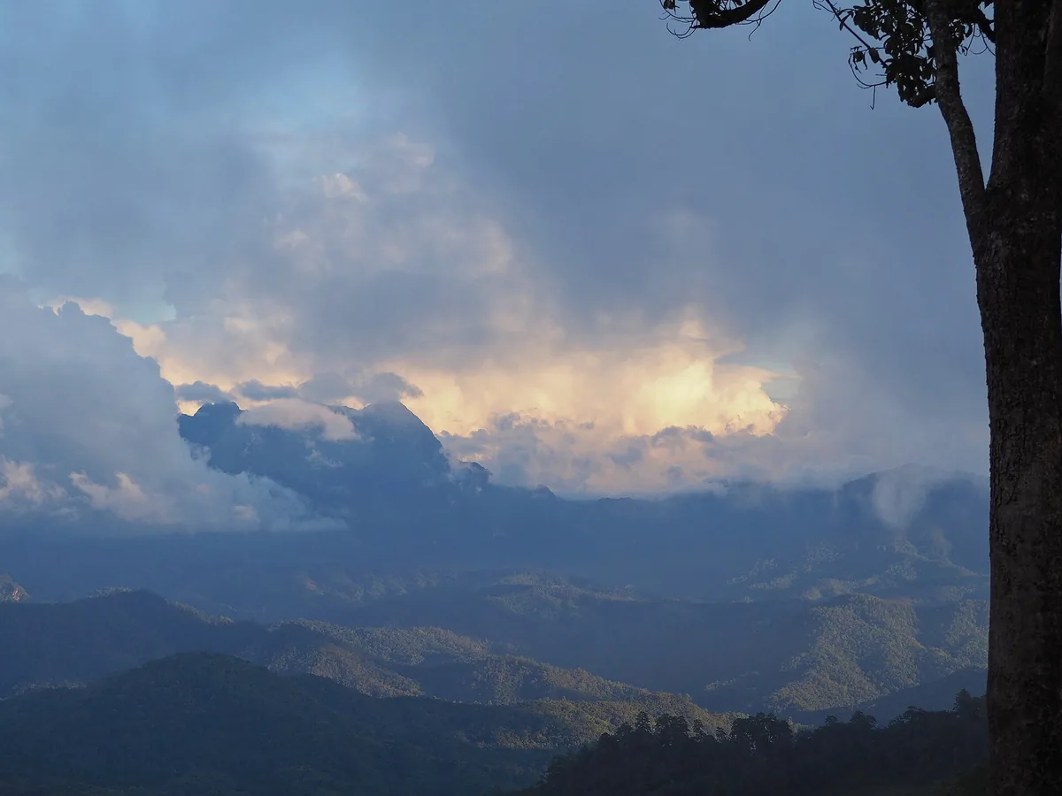
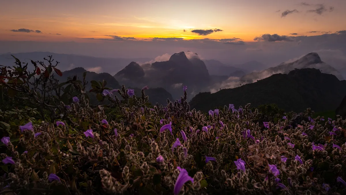
Above the forest the landscape changes completely. Jagged limestone pinnacles stand among open alpine meadows, and the slopes hold many rare plants. On a clear morning you look down on a sea of mist filling the valleys, with Doi Inthanon on one horizon and the hills of Myanmar on the other. With numbers capped, the mountain never feels crowded, but permits go fast.
The trek
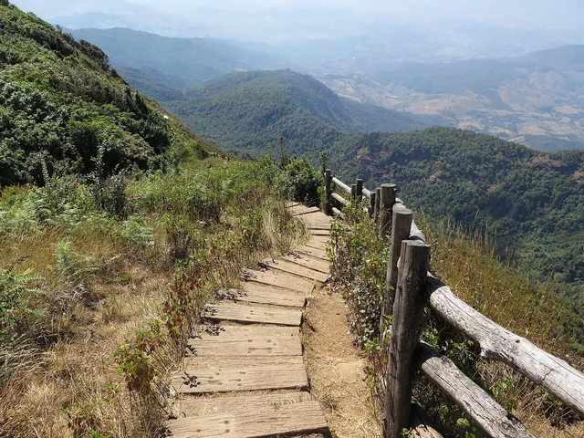
The usual route starts at the Den Ya Khat ranger station on the southern side. From there it is about 8.5 km to the camp at Ang Salung, below the summit: a long day's walk, climbing through forest and then out into open, rocky country with little shade.
The night is spent in tents at the camp. Trekkers carry their own gear or hire porters for tents, food and water, since water is scarce on the mountain. Nights in December and January drop to near freezing, so warm clothes and a good sleeping bag matter most.
Before dawn you climb the final section by headlamp to watch the sunrise over the mist, then return to camp and walk back down to Den Ya Khat, which takes most of the second day.
The trek is not technical, but it is demanding: steep, uneven ground, loose rock near the top and long hours on your feet. You need reasonable fitness and some hiking experience. If you have only done short walks, try a day trail such as Kew Mae Pan first.
Permits, guides and porters
Climbing is controlled by the Chiang Dao Wildlife Sanctuary. The basic rules:
- You need a permit from the sanctuary office. Daily numbers are capped, and permits for weekends and holidays run out early in the season.
- Every group walks with a licensed local guide. Guides and porters are booked through the local community group that works with the sanctuary.
- You pay the sanctuary entry fee plus guide and porter fees. Prices change, so confirm them when you book.
- The mountain closes outside the cool season, and can close at short notice for weather or fire risk.
Many visitors book through a Chiang Dao homestay or trekking operator that arranges the permit, guide and porters together. Either way, book weeks ahead and keep a backup date.
At the foot of the mountain
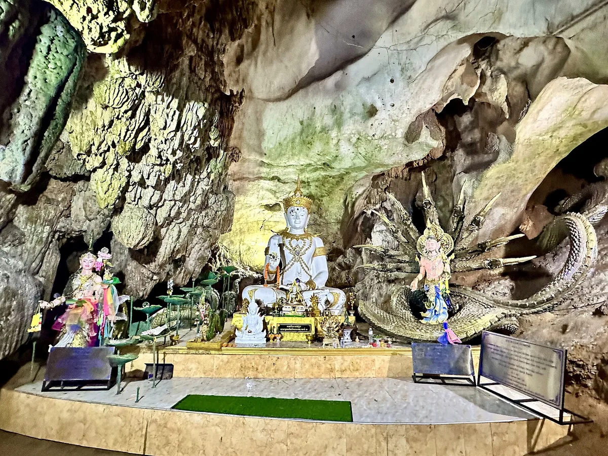
- Chiang Dao Cave (Tham Chiang Dao): a temple cave at the base of the mountain, with Buddha images in its chambers. Some sections are lit; deeper ones are visited with a local guide carrying a lantern. There is a small entry fee.
- Wat Tham Pha Plong: a quiet forest temple reached by a long staircase through the trees.
- Chiang Dao town: a small, relaxed town with homestays facing the mountain. A night here before the trek makes the early start easier.
- Birds: the forests around Chiang Dao are well known to birdwatchers, and several lodges cater to them.
How to get there
- From the Old City
- about 90 minutes by car, north on Route 107 to Chiang Dao. Your guide or homestay will give directions to the ranger station.
- From the airport or Mae Hia
- about 105 minutes by car. Mae Hia is on the opposite side of the city, so leave very early or stay the night before in Chiang Dao town.
- Own car or hired driver
- the easiest way to the trailhead. A car with driver, or a transfer arranged by your homestay or operator, works well.
- Public transport
- buses run along Route 107 to Chiang Dao town, but there is no practical public transport to the trailhead.
Tips
- Book the permit and guide first, then plan the rest of the trip around that date.
- Bring real warm layers: an insulated jacket, a hat and gloves. Nights near 0 C are normal in mid-season.
- Wear broken-in hiking shoes with good grip. Limestone is sharp and slippery when damp.
- Do not bring single-use plastic, and carry all rubbish back down.
- Stay on the trail and do not pick plants. Many flowers here are rare.
- Compare with Doi Inthanon, which you can drive up, and our Doi Inthanon day trip. The guide to the best time to visit explains the cool season, and all places and day trips list more ideas. Closer to home, Wat Phra That Doi Kham is an easy half day above Mae Hia.
FAQ
When can I climb Doi Luang Chiang Dao?
Only in the cool season, roughly November to March; the mountain is closed the rest of the year.
Do I need a permit and a guide?
Yes. A sanctuary permit, a licensed local guide and porters are all required.
How long is the trek?
About 8.5 km from Den Ya Khat to the camp, a night in tents, and the summit at sunrise; plan 2 days.
How hard is it?
Demanding but not technical: steep, rocky ground and long days, so you need reasonable fitness.
How far is it from Chiang Mai?
About 75 km north, around 90 minutes by car from the Old City via Route 107.